 Crete Island Guide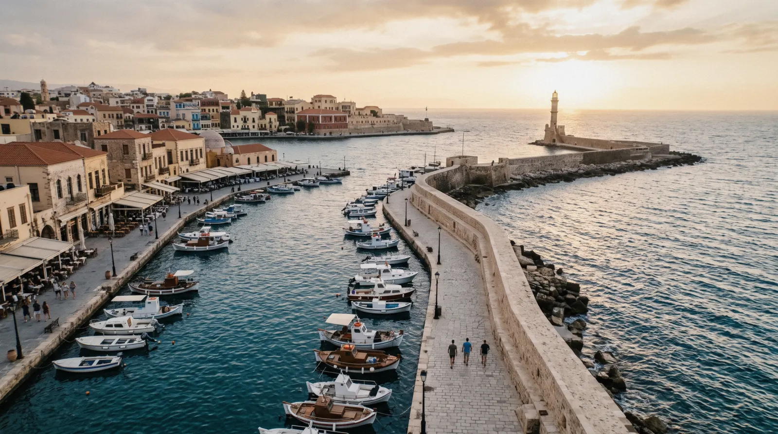
This crete map pins every town, ticketed site, beach and transit hub this Crete Island Guide covers, numbered and filterable by kind. Red pins are Ministry of Culture or national-park sites with their own entry fee, teal pins are beaches and nature, dark pins are the four towns most visitors base in, and purple pins are the airports, ports and bus or boat hubs that connect everything else. Open a pin's page for the full practical detail, or read crete costs and getting around for the money and transport layer underneath the map.
Quick answer How to read this Crete map
Crete is Greece's largest island, split into four regional units running roughly west to east: Chania (population 156,707) and Rethymno (84,866) in the west, Heraklion (305,016) in the centre, and Lasithi (77,819) in the east, a 2021 census total of 624,408 people. Two airports serve opposite ends of that range, Chania (CHQ) in the west and Heraklion (HER) in the centre-east, and this crete map pins every ticketed site, beach, base town and transit hub this guide covers between them, numbered and filterable by category. Red pins carry a stated entry fee, teal pins are beaches and nature, dark pins are the four base towns, and purple pins are the airports, ports and bus or boat stops that connect the rest.
Key takeaways
- Basing in one town and day-tripping to the far end of the island eats a full day on the road. The Balos coach and boat tour and the Agios Nikolaos and Spinalonga day trip both run the long drives for you.
- No single figure for the island's total length or area is confirmed on an official page, so this map works in regional units and drive context rather than a stated kilometre number.
- See getting around for how the KTEL buses, ferries and ANENDYK south-coast boats actually connect these pins, and crete car rental for when a car beats the bus.
- The Samaria Gorge pin below is closed for a weather alert as this page was checked. Read Samaria Gorge before planning a day around it.
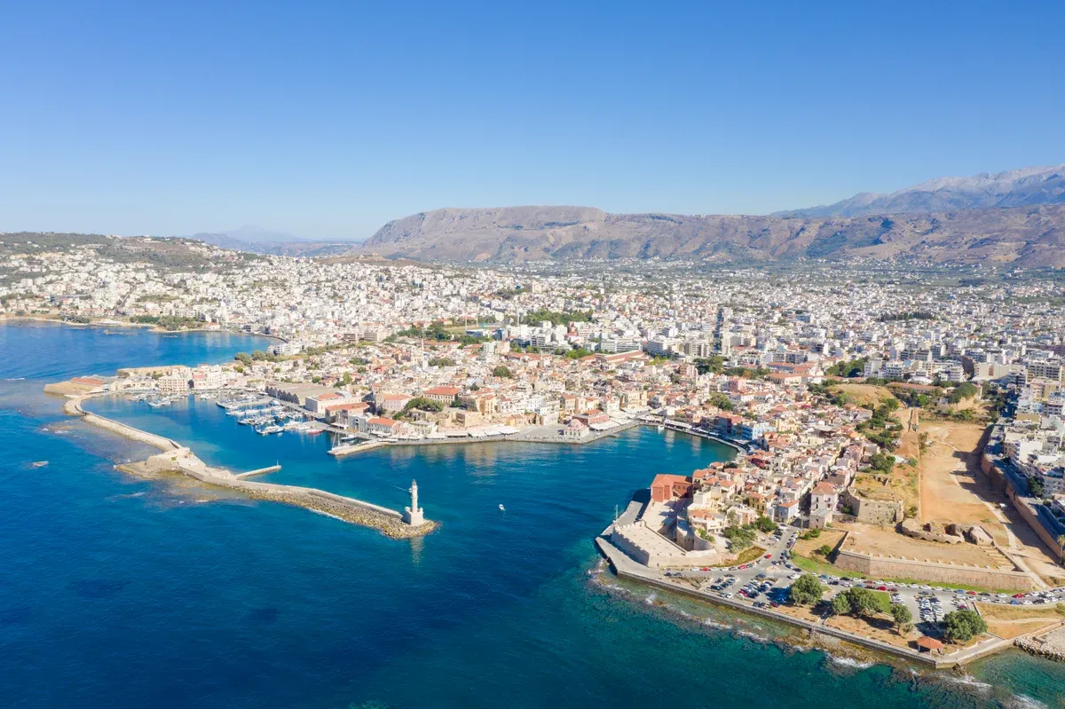
Photo: dronepicr, CC BY 2.0, via Wikimedia Commons
The Crete Map, Numbered
Every town, ticketed site, beach and transit hub in this guide, numbered and grouped into four categories: ticketed sites, beaches and nature, base towns, and the airports, ports and bus or boat hubs that connect them. Coordinates come from Wikidata, OpenStreetMap and the Ministry of Culture's own site pages, verified individually rather than estimated from a general map.
Ticketed sites 14 pins
- Knossos$22.50 (€20)Check AvailabilityThe largest Minoan palace, south of Heraklion, with the reconstructed Throne Room and the red columns Arthur Evans restored. Entry $22.50 (€20), reduced $11.23 (€10).
- Heraklion Archaeological Museum$22.50 (€20)The Minoan collection, including the Phaistos Disc and the Knossos frescoes. Entry $22.50 (€20), and tickets are valid only for the booked day and time slot.
- Koules fortress, Heraklion$11.23 (€10)The Venetian harbour fort guarding Heraklion's old port. Entry $11.23 (€10), closed Tuesdays.
- Phaistos$16.84 (€15)The second-largest Minoan palace, above the Messara plain, quieter than Knossos. Entry $16.84 (€15), reduced $8.98 (€8).
- Gortyn$11.23 (€10)The Roman capital of Crete, with the Gortyn Law Code carved in stone inside the Odeion. Entry $11.23 (€10).
- Matala caves$5.61 (€5)Roman-era rock-cut tombs above the sand beach, later a 1960s hippie hideout. Entry to the caves $5.61 (€5).
- Cave of Zeus (Dikteon Cave)$16.84 (€15)The cave above Psychro on the Lasithi Plateau where myth says Zeus was born. Entry $16.84 (€15), daily 10:30-17:30, closed Tuesdays.
- Spinalonga$22.50 (€20)Check AvailabilityA Venetian island fortress off Elounda, later a leper colony until the mid-20th century. Entry $22.50 (€20), paid at the island gate; the boat is separate.
- Samaria Gorge, Xyloskalo gate$5.61 (€5)Check AvailabilityThe upper gate of the 16 km walk down to Agia Roumeli. Entry $5.61 (€5), free under 15. Closed for a weather alert as this page was checked.
- Arkadi Monastery$4.49 (€4)A fortified monastery in the hills south-east of Rethymno, the site of the 1866 revolt against Ottoman rule. Entry $4.49 (€4), free under 16.
- Archaeological Museum of Rethymno$2.25 (€2)Check AvailabilityA small Venetian-fortress-adjacent museum with Minoan and Roman finds from the surrounding region. Entry $2.25 (€2), one of the cheapest tickets on the island.
- Archaeological Museum of Chania$16.84 (€15)Housed in the Venetian-era Chalepa district near the Firkas fortress, with finds from western Crete's Minoan and Roman sites. Entry $16.84 (€15).
- Aptera$11.23 (€10)A major ancient city-state above Souda Bay, with Roman cisterns and a Hellenistic theatre. Entry $11.23 (€10), hours step down through September and October.
- Phalasarna ancient harbourA free, unorganised ancient harbour site beside the Falassarna beach road. Entry is free, per the Ministry's own listing.
Beaches & nature 11 pins
- Balos lagoonCheck AvailabilityA shallow turquoise lagoon under the Gramvousa peninsula, reached by boat from Kissamos or a rough dirt road. Natura 2000 protected area, no official entry fee published.
- FalassarnaA long west-facing sand beach popular for sunset, beside the free ancient harbour site of Phalasarna. Not on the Blue Flag 2026 list for the Chania-west municipality.
- ElafonisiCheck AvailabilityA lagoon and islet at the island's south-west tip with pink-tinted sand, protected as a Natura 2000 site. Not Blue Flag listed, consistent with its undeveloped status.
- Seitan LimaniaA narrow cliff-walled cove on the Akrotiri peninsula east of Chania airport, reached down a steep goat path. No official entry fee or infrastructure.
- Preveli beachCheck AvailabilityA river mouth and palm grove on the south coast below Preveli monastery, reachable by boat or a steep path. Not on the Rethymno Blue Flag 2026 list.
- Lake KournasCheck AvailabilityCrete's only natural freshwater lake, between Chania and Rethymno below the White Mountains. No official entry fee; pedal boats are a private concession.
- VaiA palm-forest beach at the island's far eastern tip, Europe's largest natural palm grove. Blue Flag 2026 listed as "Vai/Finikodasos" on the Sitia municipality list.
- Chrissi islandAn uninhabited islet south of Ierapetra reached by daily boat, with cedar forest and a shell-sand beach. The operator states disembarking on the island's interior is restricted this season.
- Dia islandA rocky, uninhabited island north of Heraklion, visible from the city's coast, reached by sailing or catamaran day trips. No official NECCA management-unit page was found for it this session.
- Imbros GorgeA narrower, less crowded alternative to Samaria, descending toward Sfakia through walls that close to a few metres apart. No official fee or hours page was found this session.
- Lasithi PlateauA high farming plateau below the Cave of Zeus, once powered by thousands of white-sailed windmills, a handful of which still turn. No ticketed entry; it is open farmland and villages.
Base towns 11 pins
- Chania old townVenetian harbour, lighthouse and the lanes behind it, built on the ruins of Minoan Kydonia. The main western base, population 156,707 for the wider regional unit.
- HeraklionCrete's capital and largest city, a UNESCO City of Gastronomy since 2023, with the Morosini Fountain and Koules fortress at its old harbour. Regional unit population 305,016.
- RethymnoThe island's third city, in the shadow of the Fortezza Venetian fortress, with the Rimondi fountain at the heart of the old quarter. Regional unit population 84,866.
- Agios NikolaosA harbour town on the Mirabello gulf built around Voulismeni Lake, the usual base for Spinalonga boats. Capital of the Lasithi regional unit, population 77,819.
- HersonissosA resort strip east of Heraklion with a long Blue Flag-listed beachfront and the island's densest nightlife concentration.
- MaliaA beach resort east of Heraklion known for its strip of bars, sitting beside the separate, older Malia Minoan palace site.
- EloundaAn upscale resort village opposite Spinalonga, extensively Blue Flag listed across its hotel-front beaches.
- Kissamos$6.29 (€5.60)The western port town for Balos and Gramvousa boats, with KTEL connections on to Elafonisi. Fare from Chania $6.29 (€5.60).
- Paleochora$10.21 (€9.10)A quiet south-west coast town at the end of the Chania KTEL line, the departure point for boats along the south coast. Fare from Chania $10.21 (€9.10).
- Loutro$12.35 (€11)A car-free fishing village on the south coast reachable only by ANENDYK boat or on foot. Fare from Hora Sfakion $12.35 (€11).
- Plakias$6.17 (€5.50)A low-key south-coast beach town below Rethymno, linked by a direct KTEL run. Fare from Rethymno $6.17 (€5.50).
Airports, ports & transit 7 pins
- Heraklion Airport (HER)Nikos Kazantzakis International Airport, 5 km from Heraklion's centre, not part of the Fraport concession that runs Chania's. See Heraklion airport for transfers.
- Chania Airport (CHQ)$3.03 (€2.70)Ioannis Daskalogiannis Airport, run by Fraport Greece, open 00:00-23:59 daily. KTEL bus into town $3.03 (€2.70).
- Heraklion portCheck AvailabilityThe ferry terminal for Piraeus overnight sailings and Santorini fast-ferry connections. Operators run pure booking-widget sites with no published fares this session.
- Chania port (Souda)Souda Bay, one of the Mediterranean's largest natural harbours, is where Chania-bound ferries from Piraeus actually dock, not the old Venetian harbour in town.
- Hora Sfakion$10.21 (€9.10)The south-coast ANENDYK hub linking Loutro, Agia Roumeli and Gavdos by boat, and the KTEL bus terminus from Chania. Fare from Chania $10.21 (€9.10).
- Agia RoumeliThe south gate of Samaria Gorge and an ANENDYK boat stop with no road access at all; everyone arrives on foot or by sea.
- OmalosThe mountain village above Xyloskalo where the earliest KTEL buses from Chania arrive for the Samaria Gorge gate.
Numbers match the pins on the map. Use the chips to filter by category.
The Shortlist: Five Pins Worth a First Visit
Forty-plus pins is too many for one trip, so here is the short version: five pins worth the time first, in the order they reward a short visit, each with its own official or platform price.
| Pin | Why it makes the shortlist | Price |
|---|---|---|
| Knossos | The single most recognisable ruin on the island and the reason most first trips start near Heraklion | $22.50 (€20) |
| Chania old town | The Venetian harbour view everyone pictures when they picture Crete | free to walk |
| Balos lagoon | The lagoon photo that sells the whole island, by boat or a rough dirt road | boat from $56.05 |
| Samaria Gorge | Europe's longest gorge walk, when the season and weather allow it | $5.61 (€5) entry |
| Spinalonga | A Venetian fortress turned leper colony, reached only by boat | $22.50 (€20) entry |
Official and platform figures as listed on each pin's own page. Figures current for Q4 2026.
How to Read the Colours and the Numbers
The map and the category lists below are one object: every pin is numbered, and the map's filter chips narrow both the pins and the text at once.
Why Colour by Category, Not by Cost
The four colours split the map by what kind of stop a pin is, not by what it costs, because cost on this island splits unevenly within every category. A ticketed Ministry site can run $2.25 (€2) at Rethymno's archaeological museum or $22.50 (€20) at Knossos, so colouring by price would scatter the same category across the whole legend. Category tells you what to expect at the pin: a stated gate fee, a free beach, a town to sleep in, or a hub to pass through.
Filters and Numbering
The chips above the map narrow the view to one category at a time; All restores the full set. Pin numbers are fixed to each location rather than renumbered when you filter, so a bookmarked pin stays the same number whether you are looking at all 43 or just the ticketed sites.
What the Purple Pins Are For
The transit category exists because Crete punishes a map that only shows what to see. Both airports, the Heraklion and Souda ferry terminals, and the KTEL and ANENDYK hubs at Omalos, Hora Sfakion and Agia Roumeli are pinned precisely because the gap between two pretty pins is usually a two-hour drive or a boat that runs once a day.
What Is Not on This Map and Why
A pin is a promise that a place is reachable and verified, so a few things are deliberately left off.
No Hotels or Restaurants
Businesses only earn a pin from a citable list or their own official page under this guide's rules, and lodging is handled better on where to stay, where the areas carry their own addresses. A hotel pin here would age the moment a property changes hands or closes for the season.
No Driving Times in Kilometres or Minutes
e-ktel.com and ktelherlas.gr publish routes and frequencies but push fares and journey times into a JavaScript booking widget that does not expose a static figure for every leg, and the operator pages for Piraeus and Santorini ferries do the same. Where an official time exists, the linked page states it and names its source; where it does not, this map will not invent one.
No Island-Wide Length or Area Figure
Crete's total area is cited inconsistently across sources, sometimes with and sometimes without its offshore islets, and no official Greek government geography page settled it this session. Rather than print a number that half of the island's own reference sites disagree with, this map uses the four regional units and their census populations instead, each individually confirmed.
No Wildlife or Seasonal Pins
Nothing here claims a turtle nesting beach or a specific wildflower bloom, because those things move by year and season in ways a fixed pin cannot responsibly promise. Seasonal detail belongs on best time to visit and crete weather, not on a map that is supposed to stay accurate past one trip.
Pin-selection rule: about this site.
How the Island Is Shaped, and What No Road Reaches
Crete reads as a single coastline on a phone screen and drives like four separate regions joined by one highway.
One Highway, Four Regions
The national road runs the length of the north coast, linking Kissamos, Chania, Rethymno, Heraklion and on toward Agios Nikolaos, and almost every pin on this map sits within a short detour of that single corridor. The south coast is the exception: Paleochora, Hora Sfakion, Loutro and Agia Roumeli have no coast road connecting them to each other at all. Loutro, in particular, has no road access whatsoever.
Every arrival and departure is on foot over the mountains or by ANENDYK boat.
The Mountain Spine
The White Mountains in the west and the Lasithi range toward the east force the few cross-island roads into passes rather than straight lines, which is why a trip from Chania to Agios Nikolaos reads as a short map distance but a long driving day. The Lasithi Plateau pin sits inside this spine, a farming basin reached by a single winding approach road rather than a through-route.
Why Some Beaches Have No Pin of Their Own Operator
Balos, Elafonisi and the Lasithi Plateau's surrounding land are Natura 2000 protected areas under NECCA, and that status is exactly why no official entry fee is published for any of them. Protection, not oversight, is the reason the price cell sits empty on this map for those three pins.
What the Season Changes on This Map
A handful of pins on this map work on a calendar, not a clock, and the map itself does not change to show that, so it is worth stating plainly here.
Samaria Opens and Closes by Month
The Samaria Gorge pin is only walkable 1 May to 15 October, extending to 31 October in favourable conditions per the park's own wording, and it closes without notice during red-code weather alerts, as it is closed right now. Outside that window, the Xyloskalo and Agia Roumeli gates pin a trail that simply is not open.
Spinalonga's Winter Closure
Spinalonga runs 08:00-20:00 daily through October but closes for the winter from 1 November to 31 March, open only on request for groups. A Spinalonga pin visited in January is a boat trip to a locked gate unless you have arranged a group visit in advance.
KTEL and Boat Schedules Shift With the Season
The printed Chania KTEL timetable this pack used carries its own short validity window, and the Samaria-gate bus route returned no live booking result the day this page was checked, consistent with the gorge's current closure rather than a cancelled route. Treat any departure time on a linked page as the season's current schedule, not a fixed yearly fact.
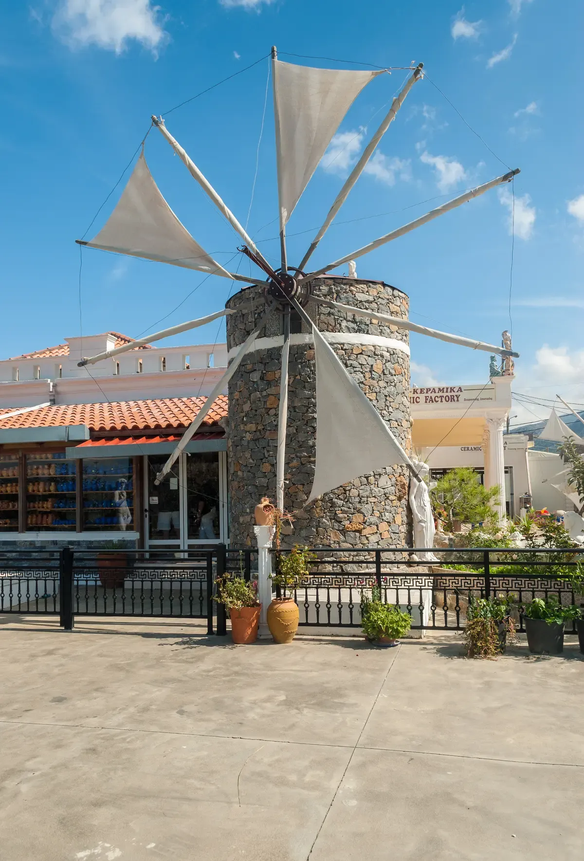
Photo: Mihael Grmek, CC BY-SA 4.0, via Wikimedia Commons
Where to Go Next From This Map
Three pages that turn these pins into an actual route.
Getting around Crete
How the KTEL buses, ferries and south-coast ANENDYK boats actually link the pins on this map.
Island-wide Check info & availabilityCrete car rental
When a rental car beats the bus, and the mountain and dirt-road routes worth knowing before you book one.
Island-wide Check info & availabilityCrete in 5 days
A built itinerary that strings a realistic set of these pins into one trip.
A sample route Check info & availabilityCrete Map Questions
Where is the nicest area of Crete?
It depends on what the trip is for. Chania old town pulls the most first-time visitors for its Venetian harbour; the south coast around Loutro and Plakias is quieter and car-free in Loutro's case; Elounda and Agios Nikolaos suit a resort-based stay in the east. This map pins all of them so the choice is visual rather than guessed.
Is it safe to go to Crete right now?
This page does not track real-time safety advisories; see is Crete safe for that question specifically. What this map does flag is a current, dated condition: the Samaria Gorge gate is closed for a weather alert as of this page's check.
What country does Crete belong to?
Crete is part of Greece, its largest island and one of thirteen administrative regions, divided into the four regional units pinned on this map: Chania, Rethymno, Heraklion and Lasithi.
How many pins are on this Crete map?
43, split into four categories: ticketed Ministry of Culture and park sites, beaches and nature, the four base towns, and the airports, ports and bus or boat hubs that connect them.
Can I see the whole island in one trip using this map?
Not comfortably in under a week. The island runs across four regional units connected by one coastal highway, and the south coast towns have no road links to each other at all. Crete in 7 days builds a realistic route; cramming all 43 pins into less time means mostly driving.
Why does the map show empty prices for some beaches?
Balos, Elafonisi and the land around the Lasithi Plateau are Natura 2000 protected areas managed by NECCA, and no official entry fee is published for any of them. An empty price cell on this map means exactly that, not an oversight.
Which pins need a car and which don't?
The four base towns and most beaches near a KTEL route are reachable by bus. Balos (beyond the boat), Seitan Limania, Lake Kournas and the Lasithi Plateau are easiest with a car or a tour; see crete car rental and getting around for the specific routes.
Crete on Video
Top 10 Places To Visit in Crete - Greece Travel Guide
A fast overview of several towns and sites pinned on this map.
Video: Ryan ShirleyGuide to Visiting Crete, Greece
A general-orientation walkthrough of the island's regions.
Video: Drink Tea & TravelWhere to stay in Crete & what to do in Chania & Heraklion
A comparison of the two main base towns pinned on this map.
Video: Greece ExplainedWe may earn a commission if you book through one of our links, at no extra cost to you. Full affiliate disclosure