 Crete Island Guide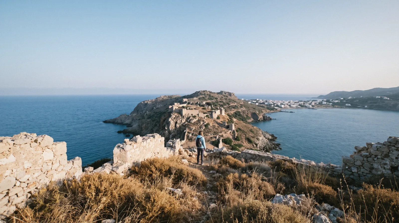
Paleochora, also spelled Palaiochora, is a small town on a narrow peninsula at Crete's south-west tip, about 70 km south of Chania. This page of our Crete, Greece travel guide covers the town's Venetian castle, its two very different beaches on either side of the same headland, the boat network that connects it to Sougia, Loutro, Chora Sfakion and the island of Gavdos, and how to actually get there.
Quick answer Paleochora in one minute
Paleochora sits on a narrow peninsula, about 400 metres wide and 700 metres long, on Crete's south-west coast roughly 70 km from Chania. A Venetian fort, the Selino Kasteli, was built here in 1278 by the general Marino Gradenigo, and its ruins still sit on the headland above the town. The peninsula gives Paleochora two beaches: a sandy stretch on the west side and a pebbled beach, Chalikia, on the east, both along the same 11 km of Libyan Sea coastline the municipality fronts. Ferry boats connect the town to Sougia, Agia Roumeli, Loutro, Chora Sfakion and Gavdos, making it one end of the south-coast boat network rather than a dead end reached only by road. The population recorded at the 2021 census was 2,181. No official source publishes a nightly hotel rate for the town.
Key takeaways
- Pair Paleochora with Elafonisi, a short drive up the coast, or book the small-group Elafonisi and Falasarna day if you are based further north.
- Exiting the Samaria Gorge at Agia Roumeli, the south-coast boats connect onward to Paleochora via Sougia; a guided Samaria day with transport builds the whole loop in.
- Compare Paleochora with the island's other quiet south-coast base on Loutro and Sfakia.
- See every Crete base side by side on where to stay.
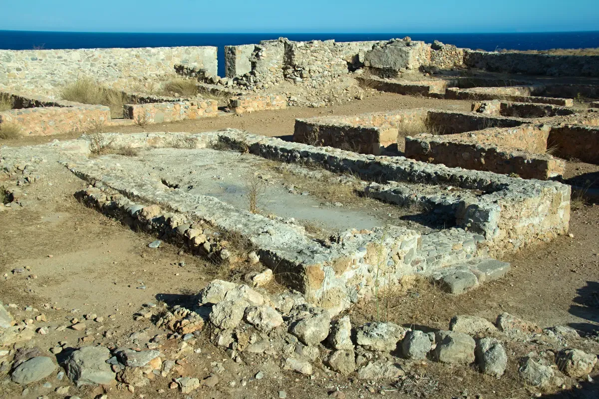
Photo: Zde, CC BY-SA 4.0, via Wikimedia Commons
What Paleochora Is: A Castle, a Peninsula, Two Beaches
Paleochora's shape decides everything about it. The town sits on a narrow spit of land with the sea on three sides, and its history and its two beaches both follow from that geography.
The Venetian Castle
In 1278, the Venetian general Marino Gradenigo built a fort here known as the Selino Kasteli, guarding the coast at the edge of Venetian Crete. The settlement went through repeated upheaval under later Ottoman rule and was largely abandoned by 1834. Resettlement of the town began again in 1866, which is why Paleochora's visible street grid is a 19th and 20th-century town built in the shadow of a much older ruin.
A Small Town Today
The 2021 census recorded 2,181 residents, making Paleochora one of the smaller named bases on this coast rather than a resort town. It occupies a peninsula about 400 metres wide and 700 metres long, with 11 km of coastline along the Libyan Sea overall once the municipality's wider stretch is counted.
History and population from Wikipedia: Paleochora.
Two Beaches, One Peninsula
Paleochora's narrow spit of land puts a different kind of beach on each side, a rare setup for a town this size.
The West Side: Sand
The western side of the peninsula carries a sandy beach, the gentler of the two and the one that fills first with sunbeds in season.
The East Side: Chalikia
The eastern side is pebbled, known locally as Chalikia, facing the open Libyan Sea rather than the more sheltered west bay. It is the quieter of the two beaches and the one with the clearer water close to shore, by the account of visitors photographing it rather than any official rating.
Beach geography from Wikipedia: Paleochora.
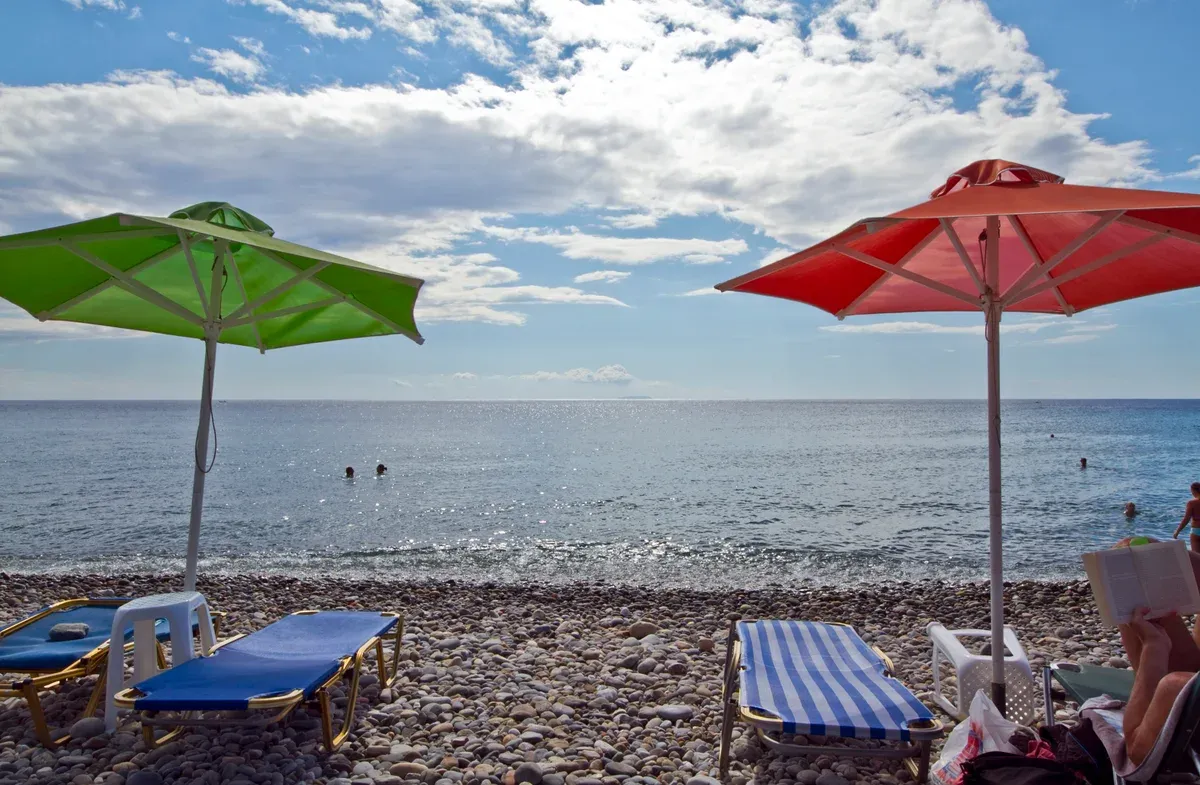
Photo: trolvag, CC BY-SA 3.0, via Wikimedia Commons
The South-Coast Boat Network, Compared
Paleochora is a hub on the south coast's small ferry network, not a dead end you drive to and back from. The table below lays out the connections and what is and is not confirmed on each leg, run by the official operator ANENDYK.
Fares below come from ANENDYK's own published price list where a figure exists. Several legs, including Paleochora's own connection to Sougia, are not priced on the operator's page and are marked accordingly rather than guessed at.
| Route | Fare | Notes |
|---|---|---|
| Chania to Paleochora (KTEL bus) | $10.21 (€9.10) | Mon-Sat 4 departures a day, Sun 3 |
| Paleochora to Sougia (boat) | Not stated | Route listed on the operator's own schedule |
| Paleochora to Agia Roumeli (boat, via Sougia) | Not stated for this leg | Connects to the Samaria Gorge exit point |
| Agia Roumeli to Loutro (boat) | $15.71 (€14) | Same south-coast network, onward to Loutro |
| Agia Roumeli to Chora Sfakion (boat) | $19.08 (€17) | The more common Samaria exit route for hikers |
| Paleochora to Gavdos (ferry) | Not stated for this leg | A separate, more frequent service than the Hora Sfakion-Gavdos run |
ANENDYK's own routes page asks travellers to confirm bus connections with KTEL Chania by phone each season, since the boat timetable is built around meeting specific buses and that pairing is reconfirmed year to year rather than fixed. Children under 5 travel free on every ANENDYK route.
Day-Tripping to Gavdos
Gavdos, Europe's southernmost point, is reachable from Paleochora by ferry, a longer and more committing excursion than the shorter hops to Sougia or Agia Roumeli. Fare and duration for the Paleochora-Gavdos leg specifically are not published on an official page we could verify, so confirm the current schedule and sailing time locally or with ANENDYK before planning it as a single-day trip rather than an overnight.
Fares from ANENDYK's official price list, anendyk.gr, and KTEL's fare tool, e-ktel.com. Figures current for Q4 2026.
Getting There
Paleochora is reachable by road from Chania or by boat along the south coast, and the two routes suit different trips.
By Bus From Chania
KTEL runs Chania to Paleochora four times a day Monday to Saturday (08:45, 10:45, 12:45, 16:00) and three times on Sunday, at $10.21 (€9.10) one way, per the operator's own published timetable.
By Boat Along the Coast
Arriving from Agia Roumeli after a Samaria Gorge hike, or from Chora Sfakion and Loutro further east, the south-coast ferry network reaches Paleochora without a return to Chania first. Confirm the current-season timetable with ANENDYK or at the dock, since the boat schedule is rebuilt around the bus connections each year.
KTEL timetable from e-ktel.com.
Hiking From Paleochora
Paleochora sits on the same long-distance coastal path network that links the south coast's other boat-connected villages.
The E4 Path East
A coastal trail, part of the wider E4 European long-distance path network, runs east from Paleochora toward Sougia and on toward Agia Roumeli, the same stretch of path that links Chora Sfakion and Loutro further along the coast. It is a demanding, largely shadeless walk best started early.
Combining the Path With the Boat
Most visitors walk one leg and boat the rest, the same compromise travellers make between Loutro and its neighbours, rather than attempting the full coastal stretch on foot in summer heat.
Tours and Day Trips Near Paleochora
Elafonisi sits a short drive up the coast, and Samaria Gorge connects to Paleochora by the boat network above.
 from $30.56
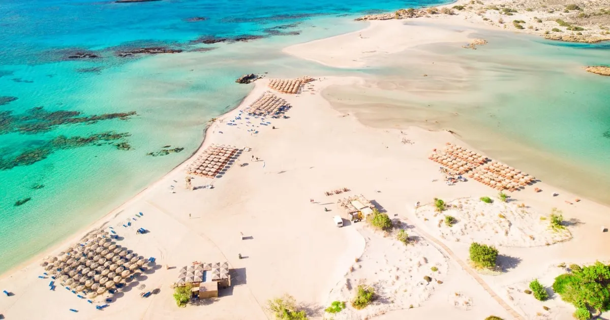
Elafonissi Beach, Free Umbrella, Honey&Wine Tasting
The budget coach day from Chania to Elafonisi with an umbrella included and a stop in the chestnut village of Elos.
Check Availability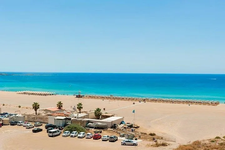 from $113.53
Elafonisi & Falasarna Small Group Tour from Chania w/snacks
A small-group day to Elafonisi and Falassarna from Chania with snacks, two west-coast beaches in one run.
Check Availability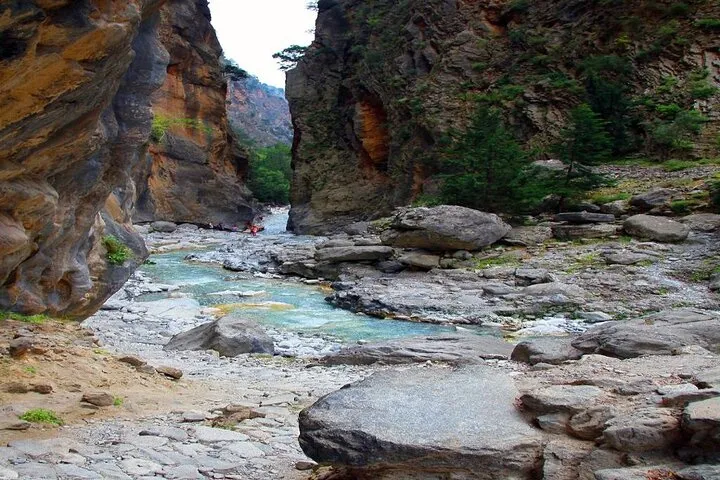 from $33.26
Full-Day Samaria Gorge Chania Guided Tour
The lowest headline price for Samaria transport and a guide; the park fee and the Agia Roumeli ferry are paid on top on the day.
Check AvailabilityPrices, ratings and details are the platform's own. dollar figures are the listed prices — the platform bills in your account's currency.
A Day or Two in Paleochora
Paleochora rewards a slower pace than a single afternoon, but a first day still has a natural shape.
Morning: The Castle and the West Beach
Walk up to the ruins of Kastro Selinou on the headland before the day heats up, then settle on the sandy west-side beach for the rest of the morning while the town's handful of cafes open for the day.
Afternoon: Chalikia
Cross the peninsula to Chalikia, the pebbled east beach, for a change of scene and clearer water close to shore, a short walk from the west side rather than a separate trip.
Evening: The Harbour
Dinner along the harbourfront, with the boats that run the south-coast network tied up for the night, closes out a day that needed no car and no booked activity to fill.
What Goes Wrong
A short list of the ways a Paleochora trip can go sideways, most of them tied to the weather and the boat network.
Weather Cancellations
The same storm systems that close the Samaria Gorge and disrupt mainland ferries also affect the smaller south-coast boats ANENDYK runs from Paleochora. Build flexibility into a Gavdos or Agia Roumeli boat trip rather than scheduling it on a single fixed day with a flight to catch straight after.
Winter Service Gaps
Both the boat network and the town's own limited restaurant and accommodation stock thin out considerably outside the main season. A winter visit is quieter in a genuinely limited-services way, not just a pleasantly empty-beach way.
Assuming a Car Inside Town
The peninsula itself is small and largely walkable, and a car is more useful for reaching Elafonisi or Chania than for getting around Paleochora's own streets. Factor that into where you park rather than assuming you will need the car daily once you have arrived.
Why Travellers Choose Paleochora
Paleochora is further from Chania than most of the island's named beach towns, which is itself part of the appeal for a specific kind of traveller.
A Slower South-West
At a 70 km drive from Chania, Paleochora takes longer to reach than Kissamos, Rethymno or Hersonissos, and that distance filters for travellers planning to stay several nights rather than pass through on a single day trip. The town's small size, 2,181 residents at the last census, and its two-beach layout suit exactly that slower pace.
A Hub, Not a Dead End
What sets Paleochora apart from a simple quiet beach town is its position on the south-coast boat network. A traveller based here can reach Sougia, the Samaria Gorge exit at Agia Roumeli, Loutro, Chora Sfakion and Gavdos without driving back through Chania first, which is not true of most other south-west bases.
Eating and Staying in Paleochora
Paleochora's small size shapes its restaurant and accommodation scene as much as its two beaches do.
Harbourfront Tavernas
Tavernas cluster along the harbourfront and the streets just behind it, serving the kind of simple grilled-fish and mezedes menu common to small Cretan ports rather than resort-style international food. Prices are not published on an official page, so treat any figure quoted elsewhere as a snapshot rather than a fixed rate.
Where People Stay
Accommodation runs mostly to small, independently run hotels and rooms-and-apartments stock rather than resort chains, in keeping with the town's population of 2,181. No official source publishes a nightly rate for any of it; compare the south coast as a whole on where to stay and see the category and fee system on Crete hotels.
When to Visit Paleochora
The south-west coast's weather pattern and the boat network's own seasonality both shape when a Paleochora trip works best.
Summer and Shoulder Months
July and August bring the fullest boats and the warmest water on both beaches, with the KTEL bus and the ANENDYK boats running their full daily schedule. May, June, September and October keep the same services running with noticeably fewer travellers, a pattern covered in more general detail on best time to visit Crete.
Off-Season
Outside the main season, bus frequency drops and the south-coast boats run a thinner timetable, consistent with the general pattern across this whole coast. A winter visit favours the castle and the two beaches on quiet, empty days over any boat-dependent day trip.
Paleochora and the South-West Coast on the Map
Paleochora sits at one end of the south-coast boat chain, with Elafonisi a short drive north.
- 1 PaleochoraA two-beach peninsula town with a 13th-century Venetian castle and south-coast boat connections.
- 2 ElafonisiThe pink-tinted sand and shallow lagoon, a short drive north of Paleochora.
- 3 Agia RoumeliThe Samaria Gorge's southern exit, reached from Paleochora by boat via Sougia.
- 4 Chora Sfakion and LoutroFurther east along the same boat network, the other quiet south-coast base.
- 5 ChaniaThe main gateway city, about 70 km north by road.
Numbers match the pins on the map.
Near Paleochora
Three pages that extend a Paleochora stay along the south-west coast and inland.
Elafonisi Beach
The nearest headline beach to Paleochora, reachable without going back through Chania first.
Short drive north Check info & availabilitySamaria Gorge
The gorge's southern exit at Agia Roumeli connects to Paleochora by the same boat network.
Boat via Sougia Check info & availabilityLoutro and Sfakia
The island's other quiet, boat-connected south-coast base, compared in full on that page.
Further east on the boat network Check info & availabilityPaleochora Questions
Is Paleochora worth visiting?
For travellers who want a quiet, small south-coast town with a Venetian castle, two different beaches and real boat connections rather than a resort strip, yes. It suits a slower few days more than a single day trip from Chania.
What does Paleochora mean in Greek?
Palaiochora combines palaia (old) and chora (village or place), so the name translates roughly as old village or old place. The current town was resettled from 1866, after the earlier settlement on the site was largely abandoned by 1834.
What is the best beach in Paleochora?
The town has two, on either side of the same narrow peninsula: a sandy beach on the west side and Chalikia, a pebbled beach, on the east facing the open Libyan Sea. Which is better depends on whether you want sand underfoot or the clearer water off the pebbles.
How do you get from Chania to Paleochora?
KTEL runs the route four times a day Monday to Saturday and three times on Sunday, at $10.21 (€9.10) one way. The drive takes roughly the same route by car, about 70 km.
Can you take a boat from Paleochora to the Samaria Gorge?
Yes, indirectly. The south-coast boat network connects Paleochora to Agia Roumeli, the gorge's southern exit, via Sougia, run by the official operator ANENDYK. Confirm the current timetable before relying on it for a same-day connection.
Can you reach Gavdos from Paleochora?
Yes. Ferry boats connect Paleochora with Gavdos, a separate and generally more frequent service than the Hora Sfakion to Gavdos run. Fare and duration for this specific leg are not published on an official page we could verify.
Can you visit Paleochora without a car?
Yes. The KTEL bus from Chania reaches the town directly, and Paleochora itself is small enough to walk between both beaches, the castle and the harbour without a vehicle.
Is Paleochora good for hiking?
Yes. A coastal trail, part of the E4 long-distance path network, runs east toward Sougia and Agia Roumeli, the same stretch that links Chora Sfakion and Loutro further along the coast.
Paleochora on Video
Paleochora, Crete – Why Everyone Falls in Love With This Town
A visitor's walk through the town and its two beaches.
Video: THAT GREEK GUYPaleochora 4K, Crete: top beaches and places | Complete Travel Guide
A wider look at the beaches and sights around the town.
Video: Tourismos Travel GuruPaleochora Crete | Virtual Tour On A Beautiful Village In Chania Greece 4K
A walking tour of the town centre and the Venetian castle headland.
Video: TouristerWe may earn a commission if you book through one of our links, at no extra cost to you. Full affiliate disclosure